![]()
 |
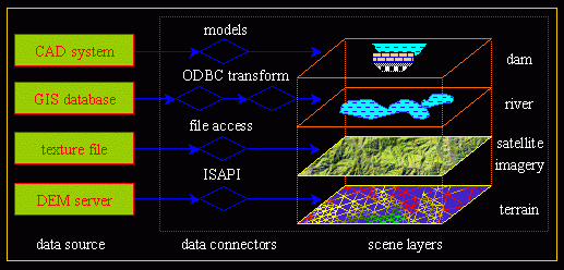
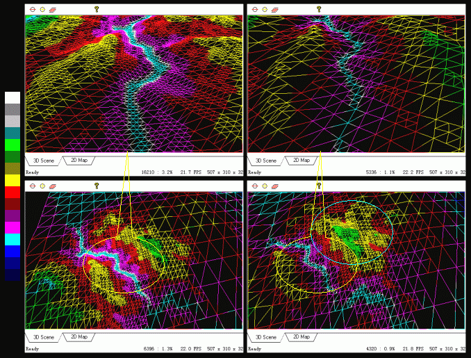
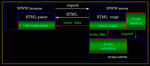
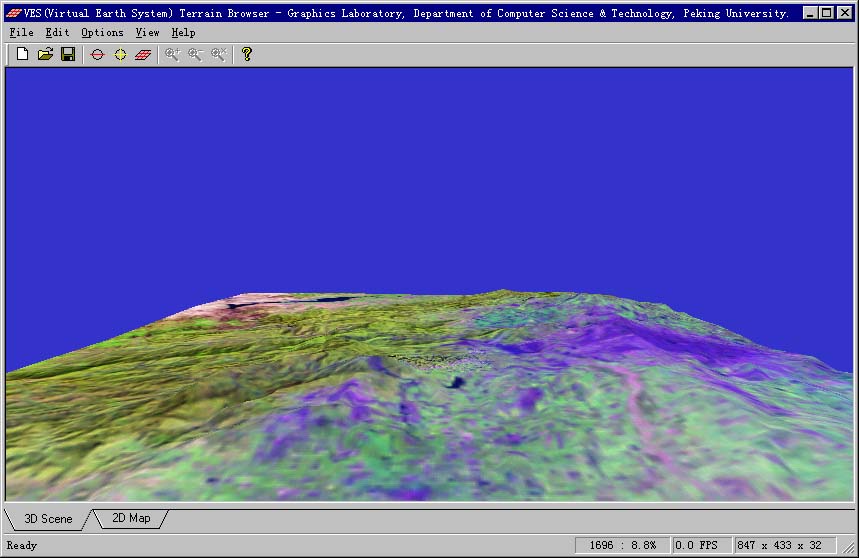
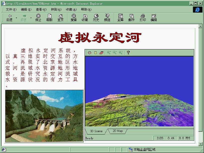
| Internet-Based Three-Dimensional Terrain Visualization System (in collaboration with Hongwu Wang, 1998.9~2000.5), sponsored by the Ninth Five-Year-Plan of P. R. China, was one of the earliest research efforts geared toward the "Digital Earth" initiative ("The Digital Earth: Understanding our planet in the 21st Century" by the U.S. former vice president Al Gore) that seeks to establish a virtual world based on the Internet for geo-spatial exploration, information exchange, distributed collaboration, and remote interoperability. This project addressed heterogeneous geo-data visualization (using a multi-layer data integration model, Figure 1), specifically geometric simplification (through a view-dependent multiresolution representation strategy, Figure 2), hierarchical storage, progressive transmission, and interactive visualization of large-scale terrain data over the Internet (using a component-based Client / Server visualization framework, Figure 3). This project led to the development of a prototype system called VES (Figure 4) and an ActiveX component (Figure 5) for visualization of the terrain along the Yongding River. |
 |
|
Figure 1. A multi-layer integration
model for heterogeneous geo-data visualization.
|
 |
|
Figure 2. View-dependent multi-resolution
terrain representation.
|
 |
|
Figure 3. A component-based Client
/ Server visualization framework for Internet-based terrain exploration.
|
 |
 |
|
Figure 4. VES terrain visualization
system.
|
Figure 5. An ActiveX visualization
component embedded in IE.
|